
















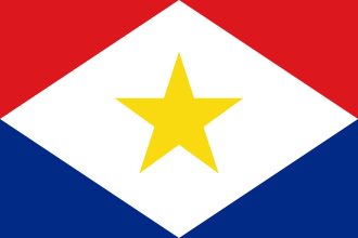
Saba has a land area of 13 square kilometers (5.0 sq mi). The population was 2,158 in January 2025, with a population density of 147 inhabitants per square kilometer (380/sq mi). It is the smallest territory by permanent population in the Americas. Its towns and major settlements are The Bottom (the capital), Windwardside, Zion's Hill, and St. Johns.
Etymology
Theories about the origin of Saba's name include siba (the Arawakan word for 'rock'), sabot, sábado, and Sheba. The island was referred to by its present name, Saba, as early as 1595 when it appeared in a voyage account by John Hawkins. Before its present name, the island was designated "St. Christopher" (San Cristóbal) by Christopher Columbus.
History
Precolonial
Archaeological evidence indicates that Saba was first inhabited around 3300 years ago, with the earliest known site at Plum Piece dating to approximately 1300 BC. The island's isolation and rugged terrain suggest that its early settlers possessed advanced maritime navigation skills, likely originating from South America.
Over 20 pre-Columbian sites have been found in Saba. The main occupation in Saba seems to have occurred between AD 400 and 1450. During this time the inhabitants of Saba were full horticulturalists living from the cultivation of root crops and the exploitation of the marine environment. They produced pottery vessels, made tools and sculptured objects from stone, shell, animal, bone, and coral.
Colonial
Christopher Columbus is said to have sighted the island on 13 November 1493. However, he did not land, being deterred by the island's perilous rocky shores. In 1632, a group of shipwrecked Englishmen landed upon Saba. In the 1640s, the Dutch governor of the neighboring island of Sint Eustatius sent several Dutch families over to colonize the island for the Dutch West India Company.
In 1664, refusing to swear allegiance to the English crown, these original Dutch settlers were evicted to St. Maarten by Jamaican governors pirates Edward, Thomas, and Henry Morgan. The Netherlands eventually gained complete control of the island in 1816.
18th and 19th centuries
In the 17th and 18th centuries, Saba's major industries were sugar, indigo, and rum produced on plantations owned by Dutchmen living on St. Eustatius, and later fishing, particularly lobster fishing.[citation needed] To work these plantations, enslaved people were imported from Africa.
In the 17th century, Saba was believed to be a favorite hideout for Jamaican pirates. England also deported its "undesirable" people to live in the Caribbean colonies, and some of them also became pirates, a few taking haven on Saba. As the island's coast is forbidding and steep, the island became a private sanctuary for the families of smugglers and pirates. One notable Saban pirate was Hiram Beakes, son of the Dutch councilor of the island.
In August 1857, Venezuela and the Netherlands submitted a dispute over the possession of Isla de Aves to arbitration by the Queen of Spain, because the Netherlands considered the island linked to its colony of Saba by a sand bank, and fishermen from St. Eustatius and Saba had used the place to harvest turtles and birds' eggs, while Venezuela argued that it had inherited the island from Spain which had discovered all the Caribbean islands, that the fishermen were not acting on behalf of any government but for a particular interest and that this island was not attached to the territory that the Netherlands had received.
The Spanish decision of 30 June 1865, declared that the ownership of the Island belonged to Venezuela and that the Netherlands should nevertheless be compensated. It argued that even if the two islands had been united, the sandbank was now separate from the island of Saba and that the first state to have a military force and to exercise sovereignty there had been Venezuela, which had inherited it from the Captaincy General of Venezuela.
During the late 19th century, Saba lace, a Spanish form of needlework introduced by a nun from Venezuela, became an important product made by the island's women. Throughout the late 19th century and early 20th century, the primary source of revenue for the island came from the lacework produced by these women.
During this period of time, with most of the island's men gone out to sea for extended periods, the island became known as "The Island of Women".
20th and 21st centuries
In 1943, Joseph "Lambee" Hassell, a self-taught engineer, designed "The Road" on Saba, which was built by hand by island residents. It drastically changed transport on the island, which had been carried out only by foot or by mule previously. An airport followed in 1963, and a larger pier geared for tourist boats in 1972. As a result, tourism increased, gradually becoming a major part of the Saban economy.
In 1978, Venezuela and the Kingdom of the Netherlands signed the maritime limits treaty that defined the extension of the Dutch and Venezuelan exclusive economic zone in two areas, the first between the islands of Aruba, Curaçao, and Bonaire (in front of the State of Falcon in Venezuela and next to the Los Monjes Archipelago) and a second area further north that includes the islands of Saba and St.
Eustatius, the latter taking as a reference the Isla de Aves (the northernmost point of Venezuela in the Caribbean Sea). At that time, the six islands were part of an administrative entity called the Netherlands Antilles. The treaty recognizes an equidistant or median line between the Island of Aves and the Island of Saba as a maritime boundary.
A status referendum was held in Saba on 5 November 2004, and 86.05% of the population voted for closer links to the Netherlands. This was duly achieved in October 2010, when the Netherlands Antilles was dissolved and Saba became a special municipality of the Netherlands.
Geography and ecology
Saba is a small island at 13 square kilometers (5.0 sq mi) in size and roughly circular in shape. It lies north-west of Sint Eustatius and south-west of Saint Barthélemy and Sint Maarten. The terrain is generally mountainous, and the center of the island is dominated by its volcanic peak, Mount Scenery, which stands 870 m (2,850 ft) above sea level. Off the north coast lies the much smaller Green Island.
Saba is the northernmost active volcano in the Lesser Antilles Volcanic Arc chain of islands. At 870 meters (2,850 ft), Mount Scenery is also the highest point within the Kingdom of the Netherlands. The island is composed of a single rhombus-shaped volcano measuring 4.6 kilometers (2.9 mi) east to west and 4.0 kilometers (2.5 mi) north to south.
The oldest dated rocks on Saba are around 400,000 years old, and the most recent eruption was shortly before the 1630s European settlement. Between 1995 and 1997, an increase in local seismic activity was associated with a 7–12 °C (13–22 °F) rise in the temperature of the hot springs on the island's northwest and southeast coasts.
Being an island, Saba is home to a number of endemic species including the Saban black iguana (Iguana iguana melanoderma), Red-bellied racer (Alsophis rufiventris), Saban anole (Anolis sabanus), and Lesser Antillean funnel-eared bat (Natalus stramineus stramineus). However, several non-native species have settled on the island, including the Underwood's spectacled tegu (Gymnophthalmus underwoodi), brahminy blind snake (Indotyphlops braminus), and non-native iguanas, all of which are believed to have arrived on cargo shipments from Sint Maarten.
Climate
Due to its considerable relief, Saba boasts a higher level of precipitation than other islands. At present, the island's climate is very similar to that of mainland South America. The yearly climate of Saba can be divided into three intervals: dry, intermediate and wet periods. The dry period lasts from January to May with a monthly rainfall of around 50 to 100 mm (2.0 to 3.9 in).
The intermediate period extends from May to September, when rainfall is moderate. The final months of the year represent the wet season when precipitation is high. The temperature at sea is approximately 25 °C (77 °F).
Cloud forest
There is an 8.6-hectare (21-acre) cloud forest located at and above 825 meters (2,707 ft) on top of the mountain referred to as the "Elfin Forest Reserve" because of its high altitude mist and mossy appearance. The most dominant tree in the cloud forest is the Mountain Mahogany (Freziera undulate), although hurricanes over the years have destroyed a large number of the mature trees.
Despite the name, the mountain mahogany is not related to other mahogany species; although one species of true mahogany tree is found on the island at lower levels, the small-leaved mahogany (Swietenia mahagoni). In the underbrush of the mahogany trees, the Sierran palm (Prestoea montana) and tree ferns dominate, with a large variety of epiphytes and Orchids growing on the trunks and branches of all the trees.
Wild raspberries and plantain trees can also be found growing on most of the mountain. All seven of the Lesser Antilles Endemic Bird Area restricted-range birds occur in the Elfin Forest Reserve.
Forests
Below the cloud forest is a sub-montane forest, and the variety and average number of species are considerably less. Redwood and Mountain fuchsia tree trees grow wild in this zone, as well as cactus species, such as the prickly pear, and Seagrape trees. On the lowest southern and eastern slopes of Saba are grassy meadows and scattered shrubs.
Saba National Land Park is a 35-hectare (86-acre) national park located on the north coast of Saba. Formerly owned by the Sulphur Mining Company, the park was established in January 1998 and the property was officially turned over to the Saba Conservation Foundation in 1999.
It stretches from the coastline all the way up to the cloud forest, and encompasses all vegetation zones present on Saba.
Coastline
The coastline of Saba is mostly rubble and rocky cliffs that are 100 meters (330 ft) or taller with mostly cobble and boulder permanent beaches. The steep terrain and sheer bluffs dropping almost straight down to the ocean's edge prevents the formation of mangrove swamps or much vegetation. There are eight bays tucked into the cliffs around the island; Cove Bay, Spring Bay, Core Gut Bay, Fort Bay (location of the island's only port), Tent Bay, Ladder Bay, Wells Bay and Cave of Rum Bay.
Saba's coastline also includes the Flat Point Tide Pools, which were created by a large lava flow thousands of years ago. These tide pools are located below the airport at Flat Point, and feature large lava rock formations filled with colorful saltwater pools. The pools are home to diverse marine life, including small fish, sea urchins, crabs, and sea flora.
The shoreline of the island is of particular value to sea birds, and has been designated an Important Bird Area (IBA AN006 – "Saba Coastline") by BirdLife International. Saba is home to about sixty species of birds, many of which are sea birds that use the holes and crevices of the steep cliffs and two small islands for breeding and feed in the waters around the island.
Saba's shoreline is home to the Caribbean's largest breeding colony of Red-billed tropicbird (Phaethon aethereus). Other birds include the Common Ground Dove, the Brown Noddy, the Least Sandpiper, and the Yellow-billed Tropicbird. The Sargasso Shearwater (Puffinus lherminieri) is another common bird, and is the national bird of Saba as well as being featured on their coat of arms.
About 4.3 kilometers (2.7 mi) southwest of the island is the northeastern edge of the Saba Bank, the largest submarine atoll in the Atlantic Ocean with an especially rich biodiversity. Saba Bank is the top of a sea mount and it is a prime fishing ground, particularly for lobster.[citation needed]
Government
Relationship with mainland Netherlands
Saba became a special municipality within the Kingdom of the Netherlands after the dissolution of the Netherlands Antilles on 10 October 2010 and is not part of a Dutch province. The island's constitutional status, as well as those of Sint Eustatius and Bonaire, is set out in the Law on the Public Entities BES (Dutch: Wet op de Openbare Lichamen BES).
Sabans vote for members of the Dutch House of Representatives, the members of which are elected on a party-list proportional method. During the 2017 Dutch general election, a majority of Sabans voted for Democrats 66. Of the island's 2,000 residents, 900 were eligible to vote, and of those, 42.8% (or 385 people) voted.
Sabans with Dutch nationality are allowed to vote in elections for the Electoral College to elect the members of the Dutch Senate. The 2019 elections on Saba, held concurrently with the 2019 island council elections resulted in four of the five Saban seats in the Electoral College going to the Windward Islands People's Movement and one seat going to the Saba Labour Party.
Governor
The island governor is the head of the government of Saba. The Dutch monarch appoints the governor for a term of six years. The governor falls under the supervision of the minister of the interior and kingdom relations. The island governor chairs meetings of both the Island Council and the Executive Council.
The island's governors are also responsible for representing the island's government both in and out of court, maintaining public order, implementing policy and legislation, coordinating with other governments, and receiving and handling complaints about the island's government.
The incumbent island governor is Jonathan G. A. Johnson.
Legislature
Saba's legislative body is the Island Council, of which there are five members. Councilors are elected by the citizens of the island every four years. The Island Council holds the power to:
- Appoint and remove commissioners of the Executive Council.
- Pass ordinances to be enforced by the Executive Council.
- Ask questions of the Executive Council.
- Begin an investigation into the governor or the Executive Council.
- Approve the budget.
Following the 2023 island elections, the Windward Islands People's Movement (WIPM) holds three seats on the Island Council, while the new Party for Progress, Equality, and Prosperity held two. In 2019, Esmeralda Johnson was the youngest person ever to be elected to the council.
Members of the Island Council are:
Executive
The Executive Council, appointed by the Island Council, acts as the executive branch of government. The council has the following responsibilities:
- Day-to-day administration of the island, except for duties reserved for the Island Council or the governor.
- Executing policies and legislation passed by the Island Council.
- Establishing rules regarding the administration of the island, except the Registry.
- Appointing, promoting, suspending, or dismissing public officials, except those working for and including the registrar.
- Preparing defense of the island.
- Maintaining contact with Dutch ministries in the Hague.
- Executing policies and legislation from the national government.
The council appoints the island secretary, currently Tim Muller.
The council consists of the island governor and two commissioners appointed by the Island Council, currently both members of the WIPM. Each member of the Executive Council is assigned portfolios to oversee.
Demographics
The population of Saba was 2,158 on 1 January 2025. Saba's small size has led to a fairly small number of island families, who can trace their last names back to around a half-dozen families. This means that many last names are shared across the island, the most numerous being Hassell, Johnson and Every; these three names are shared by upwards of 30% of Saba's population.
Most of Saba's population descends from the intermixing of Africans and Europeans. Most families can trace ancestry to early Dutch, English, Scottish settlers and enslaved Africans. The population is also partly descended from the Irish who were exiled from that country after the accession of King Charles I of England, Scotland and Ireland in 1625.
Charles exiled these Irish to the Caribbean in an effort to quell a rebellion after he had forcibly procured their lands for his Scottish noble supporters.[citation needed]
Historically, Saba was traded among the many European nations that fought for power in the region. Enslaved people from Africa were also imported to work on Saba. In recent years Saba has become home to a large group of expatriates, and around 250 immigrants who are either students or teachers at the Saba University School of Medicine.
Languages
Both English and Dutch are spoken on the island and taught in schools, and both languages are official. Despite the island's Dutch affiliation, English is the principal language spoken on the island and has been used in its school system since the 19th century. Dutch is spoken by 34% of the population, while English is spoken by over 96% of the population.
The majority (67%) of Sabans speak more than one language, including English, Dutch, Spanish, Papiamento, and many others.
English is the medium of instruction in Saba schools. Dutch government policy towards Saba and other SSS islands promotes English-medium education. English can therefore be used in communications of and to the government.
Saban English is the local English vernacular spoken on the island. It has previously been described as a decreolized variety of Virgin Islands Creole English. The first dictionary of Saban English was published in 2016.
Religion
Saba has a predominantly Christian population. The main denominations are Catholicism (45%), Non-denominational Christianity (18%), Anglicanism (9%), Evangelicalism (4%), and Pentecostalism 4%, with an additional 11% adhering to other Christian denominations. In addition, 6% of the population is Muslim.
The first contact with Christians on the island occurred with the visit of Christopher Columbus in 1493, but this did not mean the immediate arrival of the Catholic Church. It is believed that the first Christian groups to settle on the island were Protestants coming from the Netherlands in 1640.
During the period of nominal Spanish domination, the island was included in the jurisdiction of the Diocese of Puerto Rico.
The oldest church on record is the Christuskerk (Christ Church), of the Anglican denomination, which was renovated in 1777 after being damaged by a hurricane, and whose exact date of construction is unknown. In the same year, Pastor Kirkpatrick also requested permission from the Dutch commander Johannes de Graaff to officially establish the Anglican Church in Saba before that some locals used the Reformed Church of the Netherlands to celebrate their baptisms.
Although the Roman Catholic Church is currently very active on Saba, it did not establish itself on the island until quite late. One of the earliest contacts includes the visit of Père Labat in 1701.
The island was also visited by the Prefect Apostolic of the Catholic Church for the Dutch Colonies in the Caribbean in 1836 Monsignor Martinus Niewindt, according to his report there was no Catholic priest to attend the island at that time. He returned in May of the same year with the Venezuelan priest Manuel Romero who had settled in Curaçao 1 year earlier for political reasons.
Communication was difficult at first because neither of the two priests spoke English, Romero spoke only Spanish and Niewindt spoke only French and Dutch. In June 1836, the first Catholic mass on the island was officially celebrated in Saba, and five children were presented for baptism.